3.12.1. Rules for drawing railway items
Railway items include railway lines and sections of lines, stations, and platforms.
In the Yandex Map Editor interface and in this section “railway” is a synonym for “railroad”.
3.12.1.1. Rules for drawing railway line sections
When drawing railway line sections, follow these rules:
- 3.12.1.1.1
-
Techniques for drawing and editing railway line sections are similar to the techniques for drawing and editing all linear items on YME (see these sections):
- 3.12.1.1.2
-
Railway lines are drawn with one line only with the exceptions specified in Section 3.12.1.1.7.
- 3.12.1.1.3
-
Railway line sections are drawn in accordance with 2.6.1.1.1. General rules for drawing linear items.
- 3.12.1.1.4
-
The map Draw all railway lines that connect stations, crossing loops, stops, block posts, and train yards, regardless of if they are related to passenger travel, what their technical condition is, or what their form of ownership is.
- 3.12.1.1.5
-
You should draw sections of siding rail and loops (i.e. those that lead to dead ends), as well as railway tracks that lead to industrial or agricultural map items, warehouses, storage facilities, or loading and unloading areas (including to carriers):
- As an “Access track” within a railway line (see Section 3.12.3.1. Type).
- Or without a connection to a railway line (see Sections 3.12.2.1. Rules for adding attributes to sections of railway lines and 3.12.3.2. Railway name).
with the exception of situations described below (in point 3.12.1.1.5.1.
- 3.12.1.1.5.1
-
Sections of access and maintenance tracks listed in Section 3.12.1.1.5 are drawn as a part of a “Railway” line type (see Section 3.12.3.1. Type) in the following cases:
Railway line sections run alongside a public road (classes 1—7, see Section 3.3.2.1. class) for at least 0.5 km.
Railway line sections intersect with public roads (classes 1—7, see Section 3.3.2.1. class) via crossings, viaducts, and overpasses.
In this case, the railway line should include railway line sections up to their last intersection with the public road.
- 3.12.1.1.7
- Parallel railway tracks within “Railway” can be drawn as separate linear items (using two lines):
If, due to terrain or urban features, they are located on separate rail beds at a distance of 100 m or more from each other.
If the tracks go around large rail yards at a distance of 100 m or more from each other.
In this case, the railway line should include the sections of each track up to the nearest junction. Do not connect the tracks into a single line leading to a station by drawing sections that do not actually exist.
- 3.12.1.1.8
-
“Railway” lines on the map must comprise an interconnected network, like in real life.
For coherence, “Railway” lines may include sections of the existing access tracks connecting the line with the main network via the shortest route.
-
Exception:
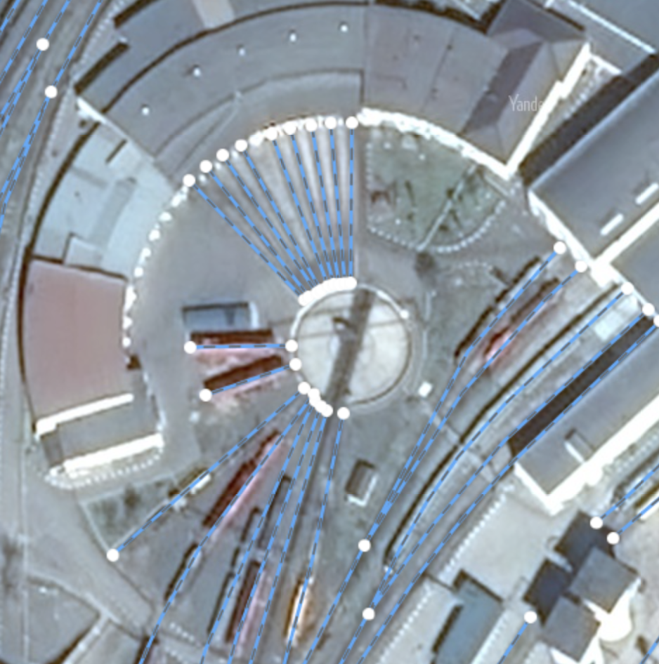
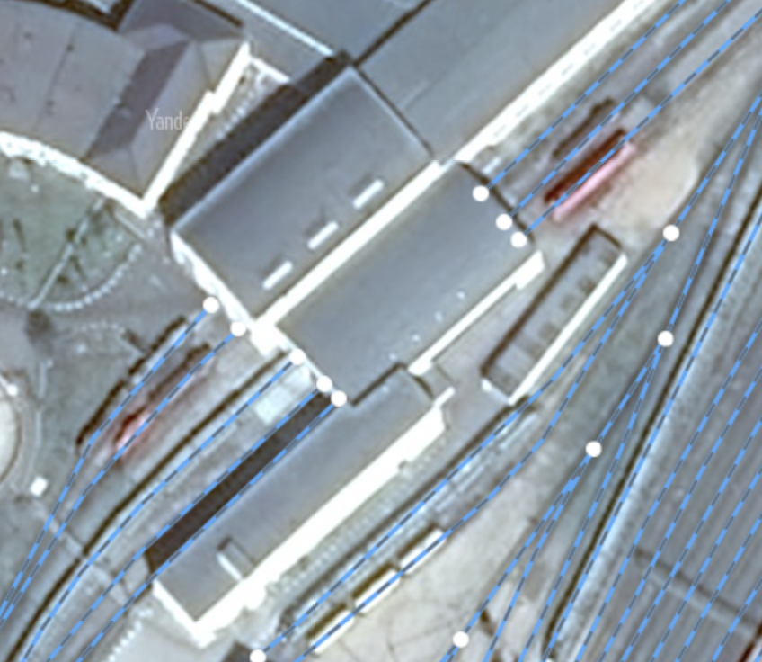
It is allowed to map railway turntable and transfer table tracks that are not connected to the railway network. Through tracks inside ground structures are not drawn on the map, even to create a connected graph.
- 3.12.1.1.9
- The same drawing rules apply to narrow-gauge railways (including children's railways), with the exception of the network coherence rule (Section 3.12.1.1.8).
- 3.12.1.1.10
-
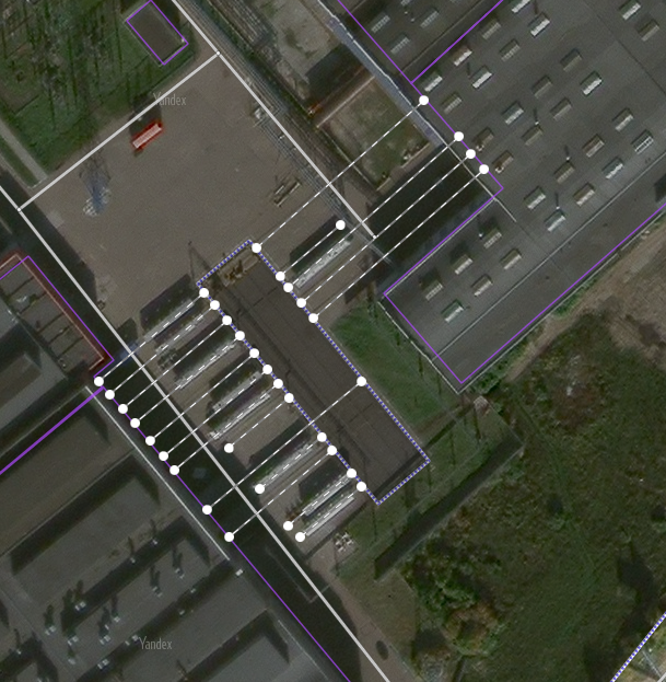
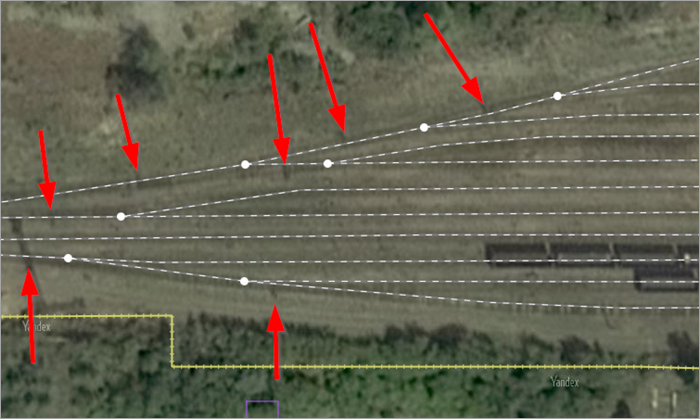
When mapping side sections of railway tracks, the beginning of each side track should be drawn from the point corresponding to the actual location of the switch (if the switch is not discernable in the satellite image, set the approximate beginning of the side track).
- 3.12.1.1.11
-
Don't draw crane rails on the map.
3.12.1.2. Rules for drawing railway stations
When mapping railway stations, junctions, stops, block posts, and rail yards, follow these rules:
- 3.12.1.2.1. Map item placement
-
Place railway icons within the building where the station is located:
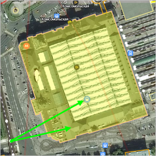
Railway stations are generally indicated with one placemark (icon) placed on the railway line at a point where the centerline is projected from the following items:
-
For example (the icon is placed on the railway line near the central point of the ticket pavilion):
- 3.12.1.2.2
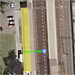
- Use two placemarks to plot passenger stations and stopping points (“stops”):
Located on separate railway tracks of different directions (for example: Bolshevo, Perm II).
If they are located along separate railway tracks that belong to the same line and are located 100 m or more apart from each other.
Situated on the transit ways, the envelopes from different sides of the large marshalling yards (for example: Yudino, Lyangasovo Pass. O. p. Central checkpoint stations Orekhovo-Zuyevo).
Note.Plot so-called “island” stations that are located between the paths of the main oncoming railroad using one placemark and link it to one of the two lines that bend around it (for example:
- 3.12.1.2.3
-
When plotting placemarks for railways or stations, make sure that they don't overlap with address points.
- 3.12.1.2.4
-
Draw stations that are not functioning but still exist as “ Non-passenger stations ”.
If a closed station was torn down, do not draw it.
3.12.1.3. Rules for drawing railway platforms
This category of map items includes platforms for the following types of transit: railways (those platforms that rise above ground level), metro stations, rapid trams, and other rapid transit.
You can draw platforms that are in use, as well as those that are decommissioned (the main thing is to map any existing platforms).
Don't draw platforms that are located completely under a roof or underground (such as underground metro stations or train stations where the platforms are located inside the building).
