2.6.2. Composite linear items
Composite linear items are created by joining simple linear items together: roads are formed by joining road sections, metro lines — metro line sections, rivers — riverbed sections, etc.
You can edit these items by changing their contents (i.e. adding or excluding sections) or changing the item's attributes (such as by renaming a street).
Since any named composite linear item is an item, it must be validated for relevance and compliance with the drawing rules as an independent item, not as an attribute of the sections it consists of.
2.6.2.1. Creating composite linear items
To create a composite linear item:
-
Create a line section (see 2.6.1.1. Simple linear items: drawing techniques) as part of a line: for example, a road section as part of a larger road.
-
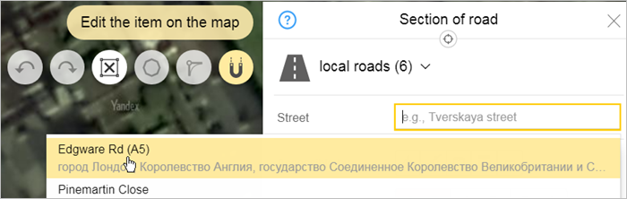
Enter a value for the Part attribute, which assigns the section to a specific line (for example, a road or metro line).
All attribute panels for composite line sections (i.e. sections of roads, sections of metro lines, sections of rapid transit lines, etc.) include this attribute.
If there are no lines on the map, this field is filled in manually (a new line is created). If the line was created earlier, then you can choose a name from the list.
-
After you save the item, the attribute panel for the section of line will look like this:
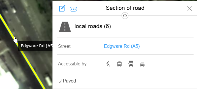
The name of the line displays in the panel as a link that opens the entire line attribute panel.
2.6.2.2. Composite linear items: editing techniques
You can edit a composite linear item by performing one of the following operations:
- Add or exclude sections of the item.
- Change attribute values (for example, by changing a street name or the administrative entity that controls a section of a railway).
To edit a composite linear item:
-
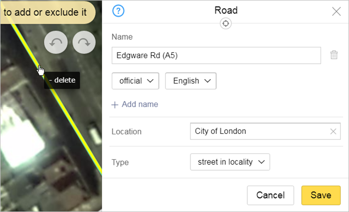
Select the section of the item you want to edit, such as a section of road (motorway, railway, etc.).
When you select it on the map, the section and the composite item that it's part of all get selected.
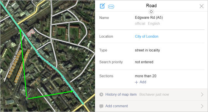
At the same time, the attribute panel for that section opens and the name of the composite item displays as a link:
-
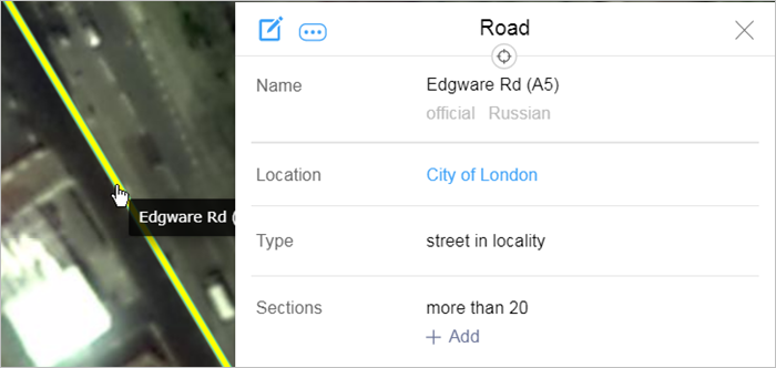
Click the link (the name of the composite item). The attribute panel for the map item opens:
-
Click Edit
 on the panel (or press Ctrl + E).
The item and attribute panel switch to editing mode (where you can edit the item's components and attribute values).
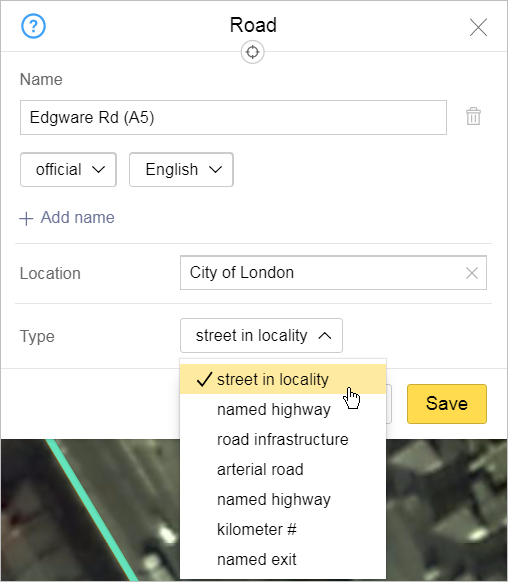
Depending on the specific item, the editing panel will include different attributes. For example, for rapid transit lines, only names can be edited; for railways — names and types. For motorways, you can edit names, types, and locations (linking the road to the administrative division where it is located):
-
Edit parts of an item:
- To exclude sections of an item, click on that section of the line.
- To include sections (that are not currently part of the item): click on that section of the line.
-
Edit attribute values of the line (in the fields of the attribute panel):
-
Names of lines are edited in much the same way names of other items on Yandex Map Editor are.
-
Enter the type of line by selecting a value from the drop-down list.
Example of editing the motorway type:
-
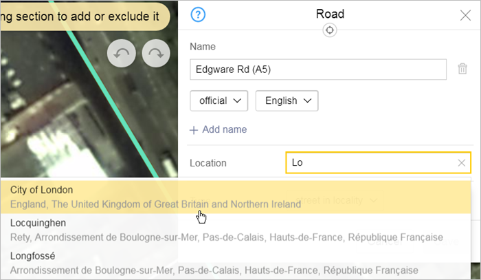
Location: enter the name of the appropriate administrative division in the field.
When you enter the names of administrative divisions, a list of suggestions will open including names of administrative divisions that were already drawn on the map. Select a name from the list:
-
2.6.2.3. Add group of motorway sections
Alert
This function is not available to all YME users
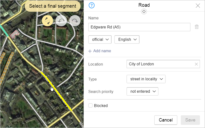
When you edit motorways, you can add sections of road as a group. Use this function to add several road sections that form a connected line to an existing road.
-
Select a section of road that is already part of the road you are adding additional sections to.
-
Go to the attribute panel for that road.
-
Click
(Edit) In the attribute panel. -
Click
 (Add group of sections) in the local toolbar.
 -
Select the beginning section of the fragment you are adding:
-
Select the ending section of the fragment you are adding:
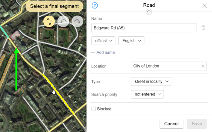
The sections of road that link the beginning and ending sections will be selected automatically.
-
Click Save in the attribute panel.
The whole fragment (from the beginning to ending sections) will be added as part of the road: