2.9. Intersections
When you draw several sections of linear items that are of the same type (sections of road, etc.), the intersections formed by two or more such sections automatically form Intersection
items.
Line intersections are items that are exclusively connected to items of a single type such as motorways or other transport lines. If a motorway intersects a metro line (or in other similar cases), then an intersection
item is not formed.
Note
When drawing roads sections, do not create new road sections or their intersection boundaries excessively.
There are several item types that can be linked with intersections:
Intersections appear on the map as circles that are the same color as the linear items they are connected to (for example, red for tram lines and white or orange for roads):
Intersections of roads and transport lines may be used to edit items.
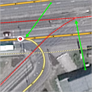
For example, the drawing of a road network doesn't correspond to the real road structure, as the drawing was not accurate enough. The road intersection and adjoining road sections were shifted from their actual positions (green dotted line):
In these situations you can edit the intersection along with all the road sections that relate to it, rather than editing each section separately.
To do this:
-
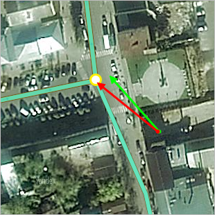
Select the intersection to open the item's attribute panel:
-
In the attribute panel, click Edit
 .
.The intersection along with all the road sections that relate to it will switch to editing mode. Drag the intersection to the appropriate place (the vertexes of the line sections that form that intersection will change their configuration when you do this) and edit the sections of road if necessary:
-
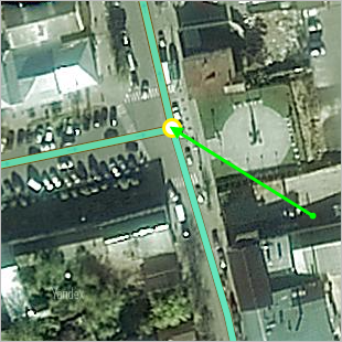
Click Save. The intersection will be saved in its new place, and the vertexes of the line sections that form that intersection will also change their position:
Note
If necessary, you can delete the intersection (for example, when several consecutive sections of road with identical attributes are joined into one section).