3.10.3. Rules for adding attributes to rivers
Rivers in Yandex Map Editor are composite linear items that are not drawn on the map, but are compiled from sections of riverbed, each of which is drawn individually and assigned separate attributes. For more information, see 3.10.2. The rules of attribution of hydrographic objects).
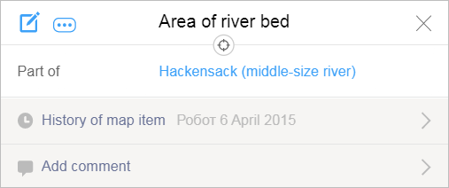
Rivers are created as individual items when you fill in the Part of attribute panel for the riverbed section (for more information, see section 3.10.2.2.1). After you create the river, its name will appear as a link in the attribute panel for that section of riverbed.

The river's attribute panel will open when you click on the link:

Click  (Edit) to switch the panel to editing mode:

Use the panel to add attributes to the river.
Techniques for adding attributes to rivers are similar to the techniques for adding attributes to all items on YME.
The attributes for River items are listed below, as well as the rules for entering values for each of them:
3.10.3.1. Type of river
3.10.3.1.1
-
Select the river type from the list in the Type field:
- Major river — a river that is at least 1,000 km long.
- Large river — a river between 400-500 km in length.
- Middle-size river — a river that is at least 20 km in length, but not longer than 400-500 km. This category also includes named streams and channels regardless of their length.
- Small river — unnamed rivers, named rivers less than 20 km long, and un-named streams.
- Stream — named streams.
- Intermittent river — all rivers that are drying up, regardless of their length.
- Channel — named channels (other than those that are labeled as major or large rivers as exceptions to the rule).
- Drainage channel — irrigation and drainage channels.
3.10.3.1.2. Connectivity of river systems
- When selecting a river type, you must preserve how the river system is connected: each class of river should connect to rivers of higher types to form a united (connected) system within the boundaries of that river basin.
3.10.3.1.3. Hierarchy of river systems
-
When selecting a river type, you must preserve the hierarchy the river system. For example, a given river can not be tributary to a lower type of river. For example, a large river can not be a tributary to a small- or medium-sized river.
Therefore, a river that relates to a lower type than its tributary based on its physical characteristics will be assigned a higher type equal to that of as the tributary.
When selecting a river type, account for its entire length, ignoring splits at state borders.
Rivers that connect channels should have a type no lower than
Middle-size river
.
3.10.3.2. Name of river
Enter the name of a river in the Part of field of the attribute panel for that section of riverbed (this is partially shown in the drawing): As you start entering the name of the river into the field, a list of suggestions comprised of rivers that are already on the map will appear automatically:

If the river is not on the map yet, you must fill in this field manually: enter a name for the new river and it will be created.
The techniques for entering river names are similar to the techniques for entering names for all items on YME.
When you duplicate a riverbed or channel using a polygon, assign Body of water attributes to that item. Don't name the following polygonal items: the Name field should be left blank (see3.10.2.1.3. Duplication of a river or channel by a contour).
If a waterway or a body of water is located within a terrain item, do not set the name of that terrain item (gulch, ravine, ditch, and so on) as the waterway name, unless that item is labeled as a quarry
.
3.10.3.2.1. Rules for naming rivers
- When naming rivers, follow the rules specified in Section 3.1.3. Map item naming rules.