2.1. Yandex Map Editor interface
The Yandex Map Editor interface displays the map itself as well as tools for working with it. Use the Create button to create and edit Yandex Map Editor items:
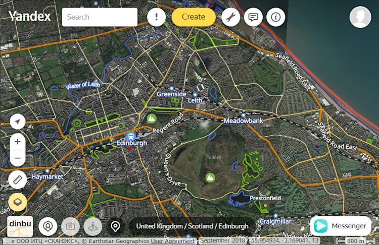
With Yandex Map Editor, you can:
-
Copy items (places and simple polygonal items).
-
Undo edits and send error reports to the moderator (so that the item will get deleted, for example).
-
Read map item comments and add your own.
-
View the history of a map item.
-
View the history of your actions on the map. To view your notifications list, click Notifications
 .
. -
Click Useful links
 in the service window and select a link from the menu (the set of links changes depending on the language, region, and your status — whether you are a user, an expert, or a moderator in Map Editor). For example:
-
Brief instructions for adding items to the map.
-
Yandex Map Editor chat.
-
Live broadcast — watch what happens in Yandex Map Editor in real time.
-
Yandex Map Editor Help — see 1. What is Yandex Map Editor.
Note
Check out short guidelines and detailed instructions on how to use Yandex Map Editor.
Click
 on the item attribution panel to bring up a short guide. Click again to see the detailed instructions (you will see a page dedicated to the particular item you're viewing).
 -
Feedback — a form for sending your question to support.
-
-
Determine your location. Just click
 (My location). This will position the map so that your current location displays in the center of it.
 -
You can find out the geographic coordinates at the center of the map (they display at the bottom of the map to the right, where the blue arrow is pointing in the drawing). You can also determine the coordinates of any other point you're interested in (they display when you click on that point and select Copy to clipboard, as indicated by the green arrow):
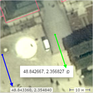
Coordinates are indicated as decimal numbers in
latitude, longitude
format. Northern latitude and eastern longitude are unsigned numbers; southern latitude and western longitude display aminus
sign before the digits.Coordinates can be used, for example, when searching for items or to send information about an item's location.
-
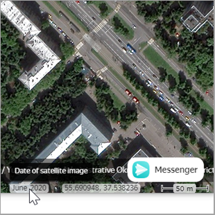
You can view the date of the satellite image displayed on the map:
-
You can evaluate the scale of the displayed map by using the scale bar that indicates the length of the corresponding segment on the terrain (in the lower right corner of the map):
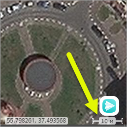
For more information about map scale, see Section 2.2.3. Change the map scale.
-
See the section of Yandex Map Editor that's currently displayed on Yandex Maps. Click
 (Go to Yandex Maps).
 -
View street panoramas. Click
 (Yandex Panoramas). A network of blue lines appears on the map, indicating where street panoramas can be viewed. Click the desired area on the blue line to open the panorama view for that area. The date when the panorama was shot is displayed at the bottom center.
If there are no panoramas for the territory you're working on, the button will be disabled. For more information, see the Panoramas section.
-
View dashboard images. Click
 (Images of the area). For more information, see Section 2.2.7. See user edits.
 -
View who edited the map near you, or recent changes.
Click
 (User edits).
 -
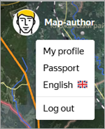
If you haven't logged into Yandex before, you will be asked to select an interface language:
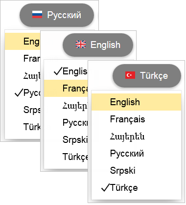
You will be able to change the menu language after logging in by clicking on your username and making a selection:
-
Open Yandex Messenger. Click
 (Messenger).
Personal messages and comments to your edits are sent to Yandex.Messenger. When you get a message, a notification appears on the screen:

You can view the Yandex Map Editor chat in Yandex Messenger. Here you can discuss issues related to Yandex Map Editor.
-
Enter problem report management mode on the map. Click Correct problems reported by Yandex users
 .
.To change your inaccuracy display filters, click Inaccuracy report settings
 .
. -
To enter the mode for accessing additional tools, click More tools
 .
.With additional tools you can enable continuous editing mode for the map, and perform group operations with map items. Such operations are only available to experts and moderators of corresponding map layers. For more information, see Section 2.10.3. Items: additional tools.
-
Find an item on the map and see its borders.
-
Change the theme. To do so, go to General settings, then to the Appearance of Yandex services section, and select a theme: light, dark, or system default. This will change the appearance of Yandex services where possible.