3.19.3. Polygonal markings
Draw polygonal markings after roadbeds.
Place polygonal markings within the roadbed. Make sure the roadbed and marking boundaries align.
If an item overlaps a roadbed with a level other than [0;0] or a Parking
roadbed, link it to that roadbed. If the roadbed is split, the polygonal markings must be split as well.
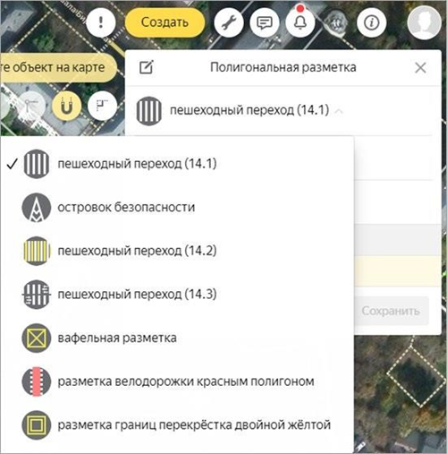
The following types of polygonal markings are available:
-
Pedestrian crosswalk (14.1–14.3, white and yellow).
-
Traffic island (white, white and yellow, red).
-
Fire lane.
-
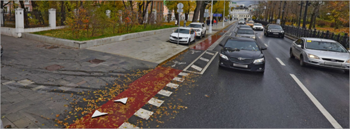
Red polygon lane marking.
-
Waffle marking.
-
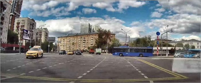
Double yellow line crosswalk marking.
-
Tram track and road intersection (UAE).
-
Tram track pedestrian crossing (UAE).
-
Speed limit.
-
Dedicated public transport lane.
-
Yellow narrow pedestrian crosswalk (SA).
-
U-turn lane (SA).
-
Green-filled bicycle polygon.
3.19.3.1. Pedestrian crosswalks (14.1–14.3)
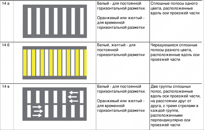
These correspond to the markings described in GOST clauses 14a, 14b, and 14c, respectively, and must follow the relevant requirements:
-
Draw each pedestrian crosswalk 14.3 (14C in GOST) as a single polygon.
-
If the crosswalk marking changes angle, draw it as multiple separate items.
-
If the standard marking direction for a pedestrian crosswalk differs from the actual crosswalk geometry by more than 45 degrees, adjust the direction accordingly.
-
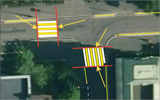
The sides of the pedestrian crosswalk that span the roadway must be parallel to each other.
Example
-
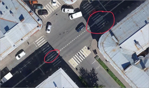
When drawing a pedestrian crosswalk, ensure that its boundaries meet and align with the boundaries of adjacent objects, avoiding any overlaps.
This rule doesn't apply if an overlap physically exists — for example, when linear markings are drawn over the crosswalk.
-
When two pedestrian crosswalks physically intersect, give drawing priority to:
-
The crosswalk that remains physically uninterrupted (if this can be determined).
-
The crosswalk that crosses the higher-class road.
-
If the road classes are equal, the crosswalk that spans the wider road.
Split the lower-priority crosswalk at the boundary of the higher-priority one to avoid overlapping polygons.
-
-
If a pedestrian crosswalk isn't marked on the pavement, but there is a pedestrian crosswalk sign, draw the crosswalk at that location.
-
If you can't close a pedestrian crosswalk at the roadbed boundary because one of its edges would end on the roadbed, use the satellite image as a reference and close the crosswalk perpendicular to the roadbed boundary.
-
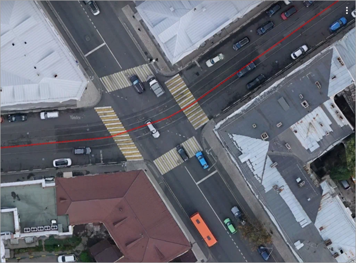
Don't draw pedestrian crosswalks over tram tracks unless the tracks have dedicated crosswalk markings:
3.19.3.2. Traffic island
Legal polygonal markings must not overlap.
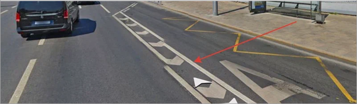
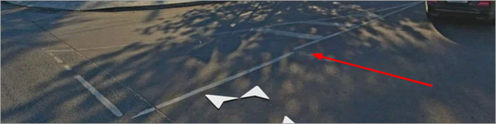
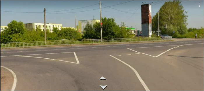
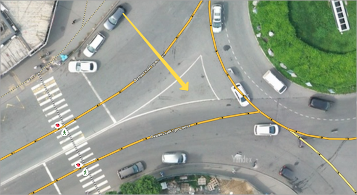
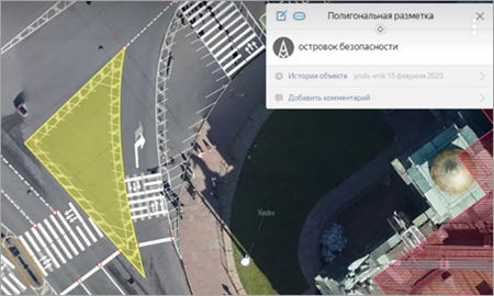
Draw all legal traffic islands as a single type. Use this type to draw legal dividers, which may serve:
-
To separate a bus lane.
-
As an exit island.
-
As a traffic island not enclosed by exits on a two-line road.
Alert
Draw a legal island using the
Traffic island
marking strictly along its boundaries. You may also add other polygonal markings that match these boundaries.Example
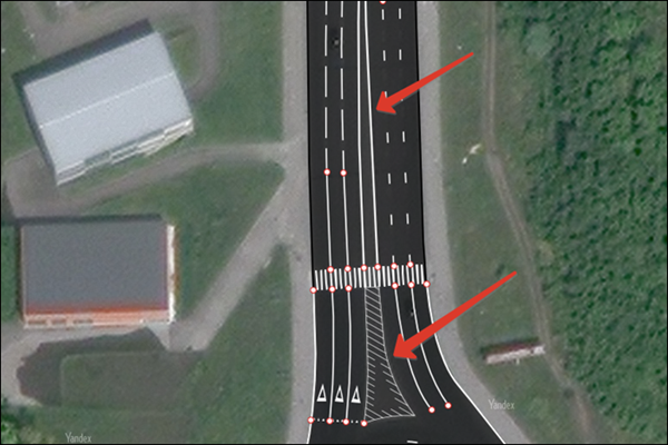
In this case, a pedestrian crosswalk overlaps the traffic island. Use the
Traffic island
marking to draw only the part of the island up to the pedestrian crosswalk, then draw the part behind the crosswalk using theEdge of the roadway
(2) linear marking: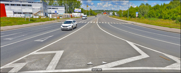
-
As a shoulder.

-
As a polygonal item with internal hatching.
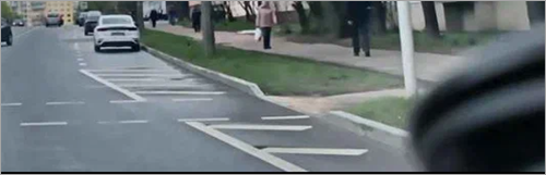
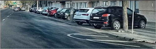
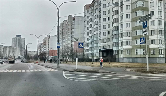
Examples
-
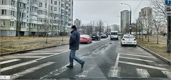
A small convex legal island at an intersection.
-
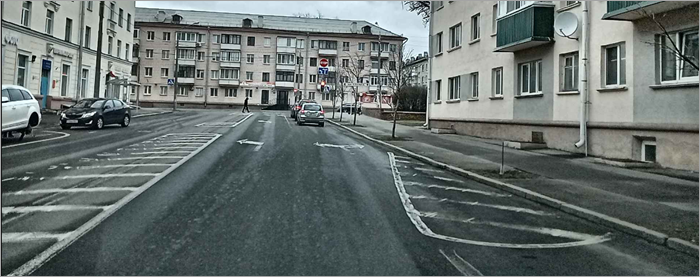
A small legal island between a parking pocket and a crosswalk.
-
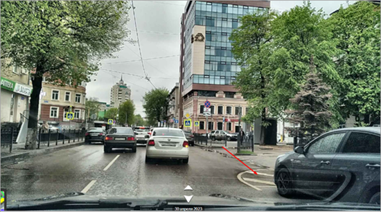
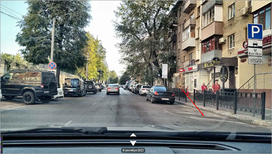
An extended legal island that continues beyond a parking pocket.
-
A legal traffic island marking the end of a parking pocket.
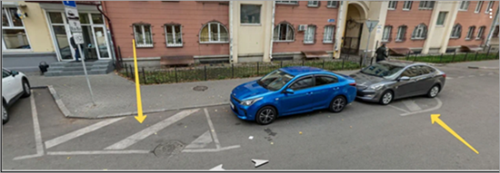
-
You may draw a shoulder section using polygonal marking 2.2 if it's delineated by a hatched line instead of a solid line (GOST Appendix A, clause 2). However, to make the transition from a polygonal shoulder to a linear one visually smooth, draw a part of the section as a polygon if the shoulder width is 0.5 meters or more.
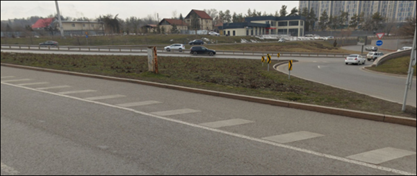
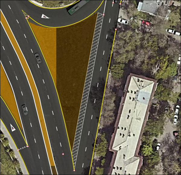
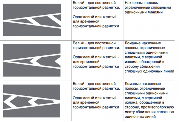
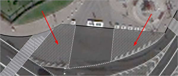
If the traffic island marking is physically interrupted by dashed lines — for example, to allow entry (see the example below) — add a gap in the island's marking to create the entry point.

Note
-
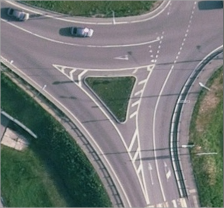
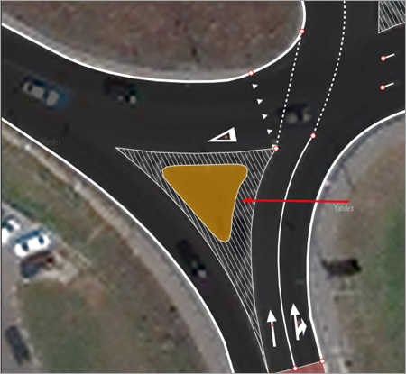
If a physical island is located inside a legal island, cut out the inner polygon in the legal island to accommodate the physical island:
-
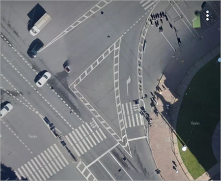
If a legal island isn't solid but has a cut‑out center, draw it as a solid shape:
-
If a traffic island transitions into a median strip of constant width or a double solid marking, the island's boundaries must end at the transition point.
-
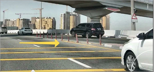
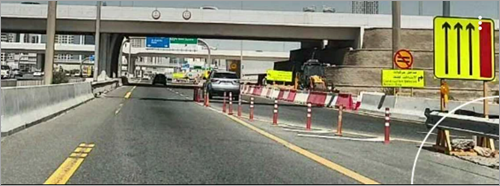
Physical and legal islands may overlap if the physical island is represented by road posts that can't be cut out of the polygonal marking due to their size.
Examples
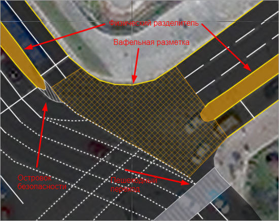
3.19.3.3. Waffle marking
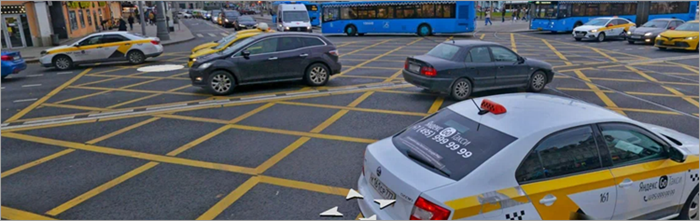
Linear markings may overlap this polygon marking type without splitting the polygon, for example:
3.19.3.4. Red polygon bike lane marking
3.19.3.5. Double yellow line crosswalk marking
3.19.3.6. Red polygon lane marking
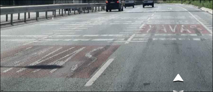
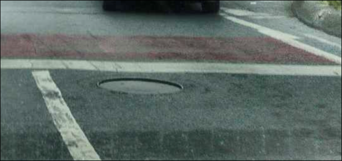
Use this marking type to draw red polygons on the roadbed, including those that serve as a background for text: